Category:Latourell Falls
Jump to navigation
Jump to search
| Object location | | View all coordinates using: OpenStreetMap |
|---|
waterfall .jpg) | |||||
| Upload media | |||||
| Instance of | |||||
|---|---|---|---|---|---|
| Location | Columbia River Gorge, Hood River County, Oregon | ||||
 | |||||
Subcategories
This category has only the following subcategory.
L
Media in category "Latourell Falls"
The following 41 files are in this category, out of 41 total.
-

-
 238 Latrourelle Falls on the O.R. & N. by Gifford (22476001246).jpg 3,004 × 4,463; 6.32 MB
-
 415 Latourelle Falls 255 Ft High CRH by C&D (22475969906).jpg 2,029 × 3,209; 3.71 MB
-
 836 Latourelle Falls on the CRH (21879197424).jpg 2,058 × 3,270; 9.28 MB
-
 ColumbiaAmericasGreatHighway016.png 1,478 × 2,528; 1.89 MB
-
 HAER HCRH OR-36-24.jpg 5,000 × 3,577; 2.25 MB
-
 HAER HCRH OR-36-25.jpg 3,563 × 5,000; 2.34 MB
-
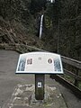
 Historic Columbia River Highway - Sign for Latourell Falls - NARA - 7719249.jpg 2,922 × 1,948; 3.8 MB
-
 Latourel Falls, Columbia River Oregon, C.R. Savage, Photo.jpg 1,618 × 2,645; 998 KB
-
 Latourell Falls (2017-05-28).jpg 2,956 × 4,435; 12.93 MB
-
Latourell Falls (2017-05-28).webm 13 s, 1,080 × 1,920; 1.67 MB
-
 Latourell Falls (3718616572).jpg 2,334 × 2,177; 656 KB
-

-

-

-

-
 Latourell Falls - Flickr - LukeDetwiler.jpg 2,979 × 4,468; 5.56 MB
-
 Latourell Falls - March 2012.JPG 3,000 × 4,000; 3.07 MB
-
 Latourell Falls - panoramio.jpg 960 × 960; 284 KB
-
 Latourell Falls 1 - Flickr - Joe Parks.jpg 1,500 × 2,036; 3.92 MB
-
 Latourell Falls 2 - Flickr - Joe Parks.jpg 1,500 × 2,458; 3.83 MB
-
 Latourell Falls and sign - March 2012.JPG 3,000 × 4,000; 3 MB
-

-
 Latourell Falls October 2019.jpg 4,016 × 6,016; 14.49 MB
-
 Latourell Falls sign - March 2012.JPG 4,000 × 3,000; 2.36 MB
-
 Latourell Falls sign, March 2012.JPG 3,000 × 4,000; 2.95 MB
-
 Latourell Falls, 2011.JPG 2,112 × 2,816; 1.65 MB
-
 Latourell Falls, Columbia River Gorge, OR 9-06a (15334636745).jpg 1,576 × 2,450; 2.31 MB
-

-
 Latourell Falls, March 2012.JPG 4,000 × 3,000; 2.68 MB
-
 Latourell Falls, OR - March 2012.JPG 4,000 × 3,000; 3.68 MB
-
 Latourell Falls, OR in March 2012.JPG 3,000 × 4,000; 3.02 MB
-
 Latourell Falls, OR, March 2012.JPG 3,000 × 4,000; 3.45 MB
-
 Latourell Falls, Oregon - March 2012.JPG 3,000 × 4,000; 2.67 MB
-
 Latourell Falls, Oregon in March 2012.JPG 4,000 × 3,000; 3.42 MB
-
 Latourell Falls, Oregon, March 2012.JPG 3,000 × 4,000; 3.02 MB
-
 Latourell Falls, Oregon.jpg 2,304 × 1,728; 982 KB
-
Latourell Falls, Oregon.webm 18 s, 1,920 × 1,080; 25.76 MB
-
 Latourell Falls.jpg 1,932 × 2,993; 3.8 MB
-
 Upper Latourell Falls.jpg 2,136 × 2,848; 1.33 MB
-


.jpg)
.jpg)
.jpg)


.jpg)
_(mulD0031).jpg)
_(mulDA0021b).jpg)
_(mulDA0026a).jpg)
_(mulDA0036).jpg)


.jpg)


